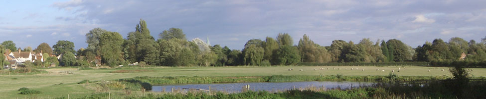

The River Stour at Nayland The Suffolk Stour was the ancient division between East Anglia and Essex but its source is in Cambridgeshire. It is 50 miles long and winds its way through the countryside until it meets the sea at Harwich. Nayland and Wissington are two of the many settlements on its banks. The river has probably had more influence on the development of the village of Nayland than any other factor while Wiston has always remained an agricultural area.
|
 |
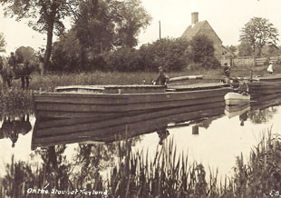
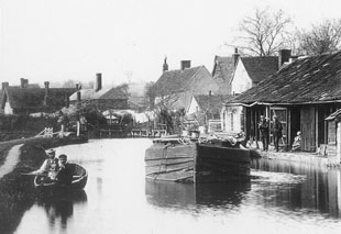
The Navigation The 1705 Act of Parliament making the River ‘Stower’ navigable from Manningtree in Essex to Sudbury in Suffolk was important for the prosperity of Nayland. The navigation was one of the earliest statutory navigations in the country and was a major means of transportation for more than 200 years. The Commissioners for the Navigation met annually from 1781 until 1914 at the Queen’s Head in Mill Street and John Constable’s father, Golding Constable, a local miller, was one of these Commissioners. Nayland was the half-way point between Manningtree and Sudbury, a total distance of 25 miles. Horsedrawn barges or ‘lighters’ carried coal and other goods upstream to Sudbury and bricks, corn, chalk, etc were taken back down to Manningtree for onward transmission to London or elsewhere. Corn milling expanded in Nayland at this time and it was not unusual for 1000 sacks of flour to be sent by barge from Nayland mill to London in a week. Nayland had several wharves where the barges stopped to unload. On the upstream journey, which took about two days, two horses pulled each lighter but only one was needed on the return journey. Thirteen locks were constructed as a result of the Act and Nayland had two in its vicinity, Nayland Lock and Horkesley Lock. Nayland Lock was replaced by a weir in 1947 and the lock cottage is only one of two which have survived. Horkesley Lock downstream did not fare so well; the lock and cottage gradually fell into ruins and the bridge over the river there which had linked Nayland with Horkesley eventually disappeared. When the Conservation Society was formed in 1974 one of its first aims was to restore the site but it was not until 1995 that the bridge was replaced and the footpath restored. see Achievements page
|
|
After the Navigation The navigation had declined with the coming of the railways in the nineteenth century and the barge traffic which had been a common sight passing through Nayland had ceased by the end of the first world war period. It was a sorry end to a cheap form for transport for heavy or bulky goods. It was not long before the river became derelict and neglected with broken down locks and fallen trees. With increased flooding a Drainage Board was set up in 1918 by the Ministry of Agriculture. River authorities were also set up and still continue today to deal with the periodic flooding experienced in the valley. Old photographs show how wide and deep the river used to be but today it is sad to see that in some sections it is only possible to travel along it in a canoe; the Nayland millstream in particular is but a trickle when compared to the days when the barges went up to the mill.
|
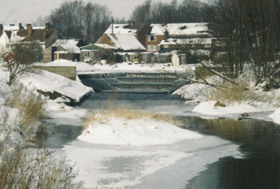
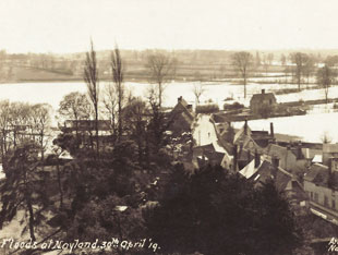 Floods at Nayland April 1919 |
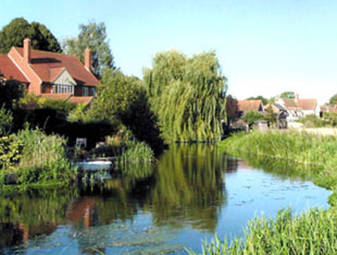
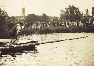
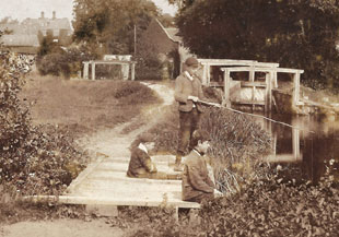
Leisure activities The river has always been a source of pleasure as well as being a working river. Until the middle of the last century, generations of children learnt to swim in the river and people have always boated up and down stream. In days gone by, we are told, the river often froze over and people used to skate on it during the winter months. It was also an ideal place for organised water sports. According to old records from the end of the eighteenth century until the second world war, annual sports days and special celebrations always included Aquatic sports such as walking the bowsprit, the tub and shovel race, swimming races and diving off Anchor Bridge. One activity which has no doubt been carried on for centuries past is fishing. However, while there are at present still plenty of fish in the river, anglers who have fished here for many years have seen the quality of the fishing decline. Until the early 1950s the River Stour was known to be one of the finest rivers in the south of the country for coarse fishing. The water was crystal clear with a gravel bed and supported, in particular, large shoals of specimen roach and dace. Fishermen came from far and wide to fish at Nayland, many of them staying at the Anchor. However, with the amount of abstraction and the many changes made by the river authority to alleviate flooding the river is now but a shadow of its former self.
|
|
How the river has changed in modern times Before the days of the navigation the river was said to be a fast running river but then the course was altered by man to suit his purposes. There was no doubt always some sort of traffic but over the centuries the river has changed and it continues to change. During the 1960s, at the time the Nayland bypass was built, major alterations were made to the river. The stream running under old Pop’s Bridge on the outskirts of the village was dug out to become the flood relief channel and the once proud main river now flows through a small channel under the A134. More recently in 2002 the Environment Agency conducted a Feasibility Study of the River Stour. Five options were discussed from increasing the possibility of more navigation through to minimal development. The Society supported Option 1 which favoured minimal change. Option 2 was finally approved which supported the improvement of landing stages for rowing boats and canoes and conservation work only. Since the acquisition of the Nayland Meadow the Society has also worked closely with the Environment Agency with regard to the maintenance of the river bank alongside the meadow and also when the Agency created the pond in the middle of the meadow. Living in Nayland residents are never far away from the river which runs its course through the village and the Dedham Vale on its way to the sea. Although considerably changed over the centuries, it is still a beautiful river and has made Nayland what it is today. |
|
 Horseshoe Weir at Nayland |
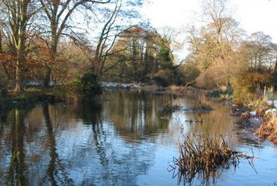
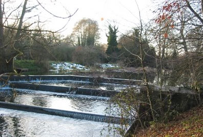 Horseshoe Weir at Wiston |
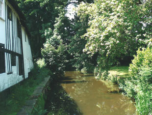
 Mill Lade, Nayland |
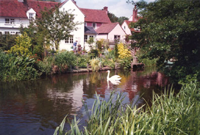
 River Stour above the lock pool at Wiston |